Public Information Line: 928-421-4579
Phone Line Hours: 8 am – 8 pm
Email: 2023.CottonwoodRidge@firenet.gov
Thunderstorms and Rain fall across the White Mountains
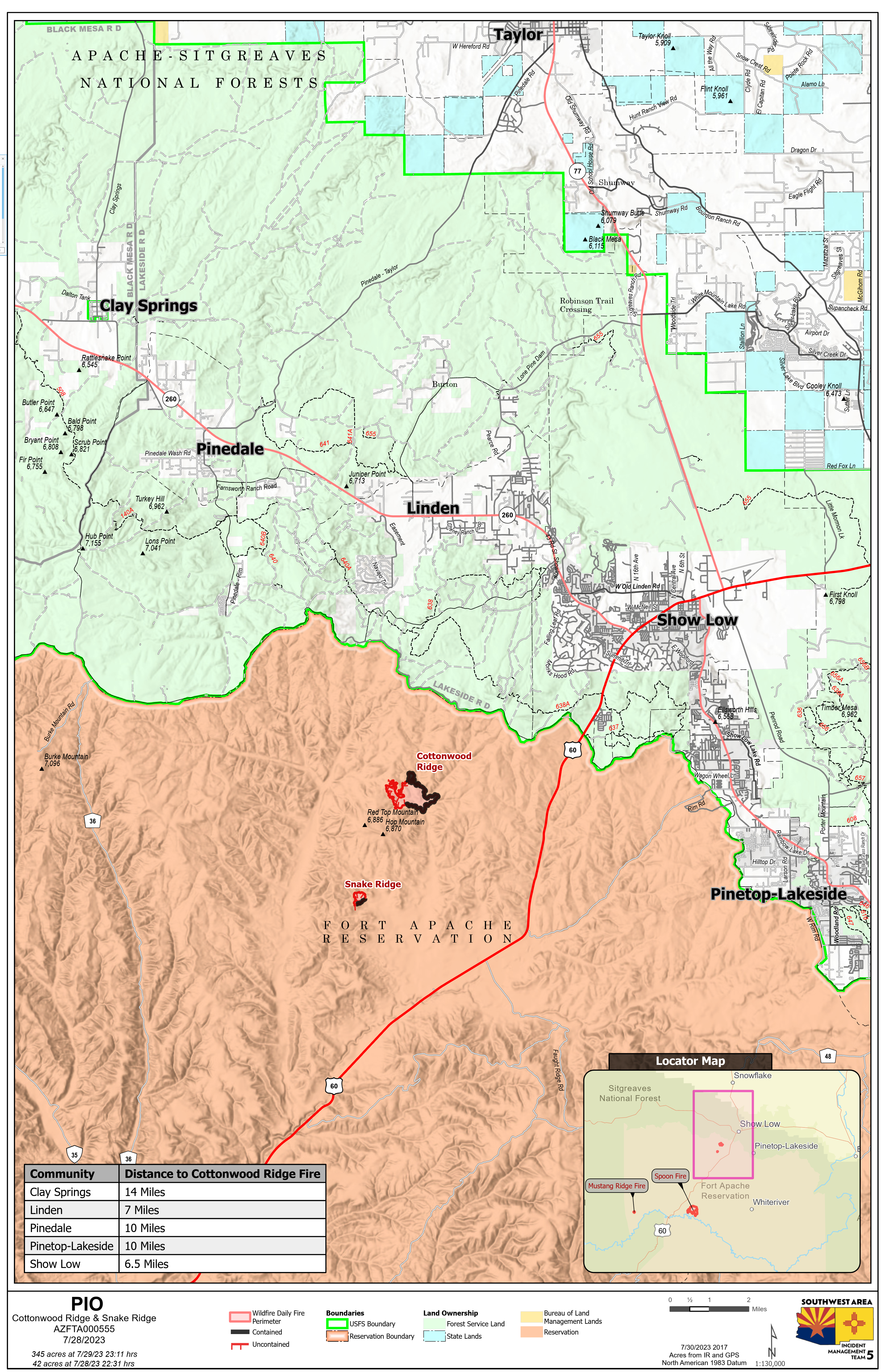
Cottonwood Ridge Fire Quick Facts
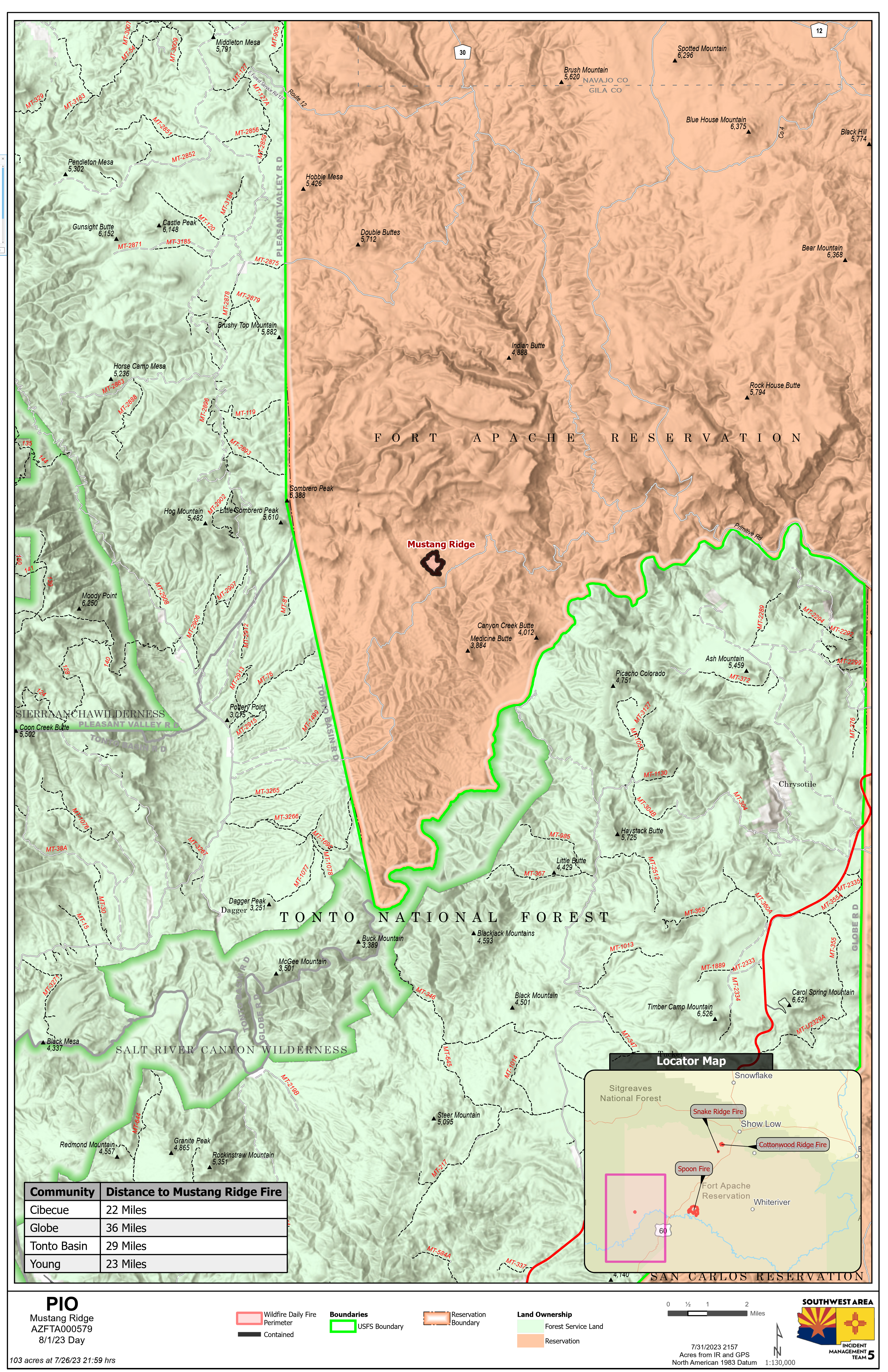
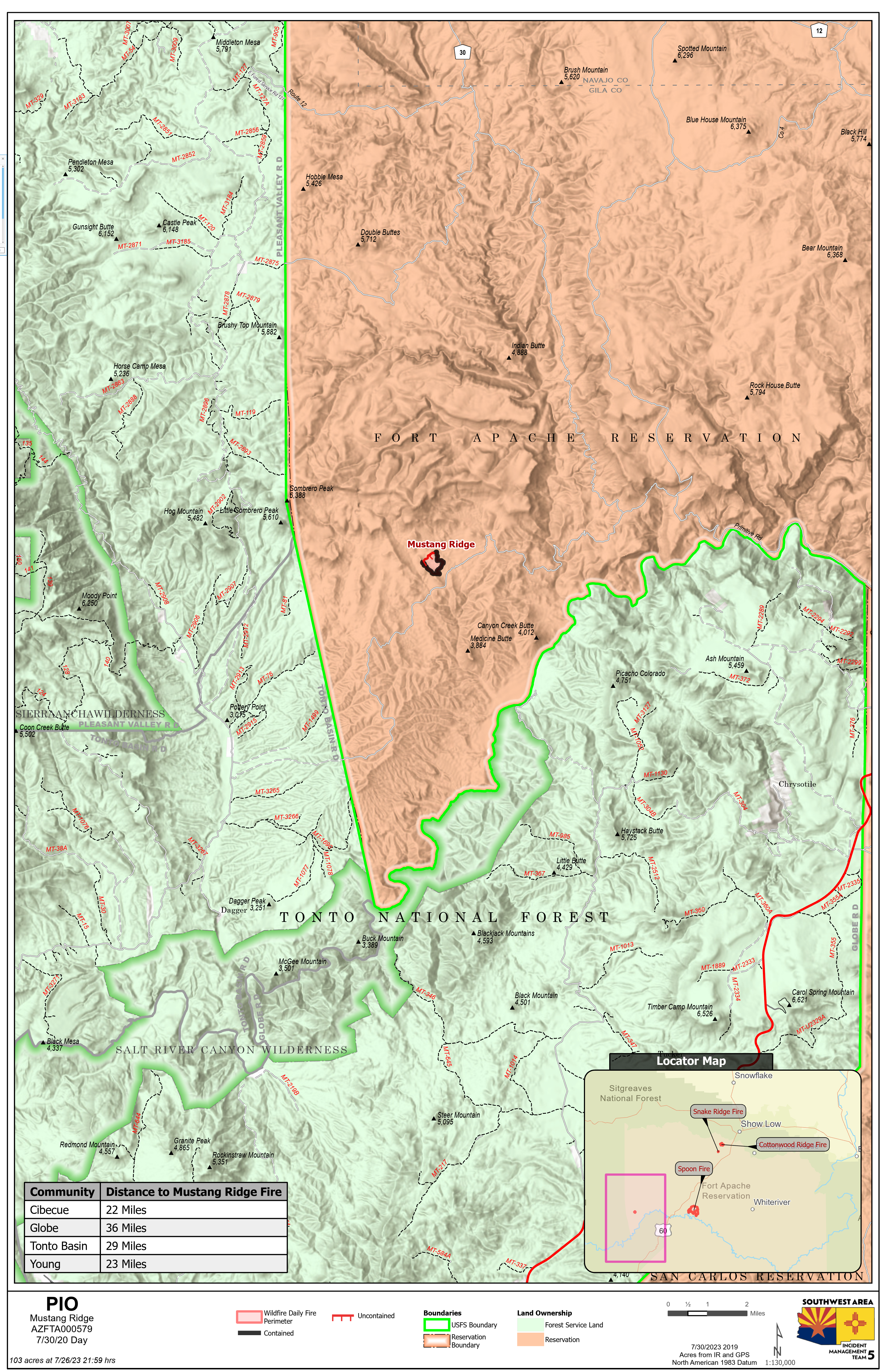
Acres: 345
Cause: Lightning
Containment: 50% Start Date: July 23, 2023
Location: 4 miles south of Show Low, AZ
Fuels: Timber, grass, brush
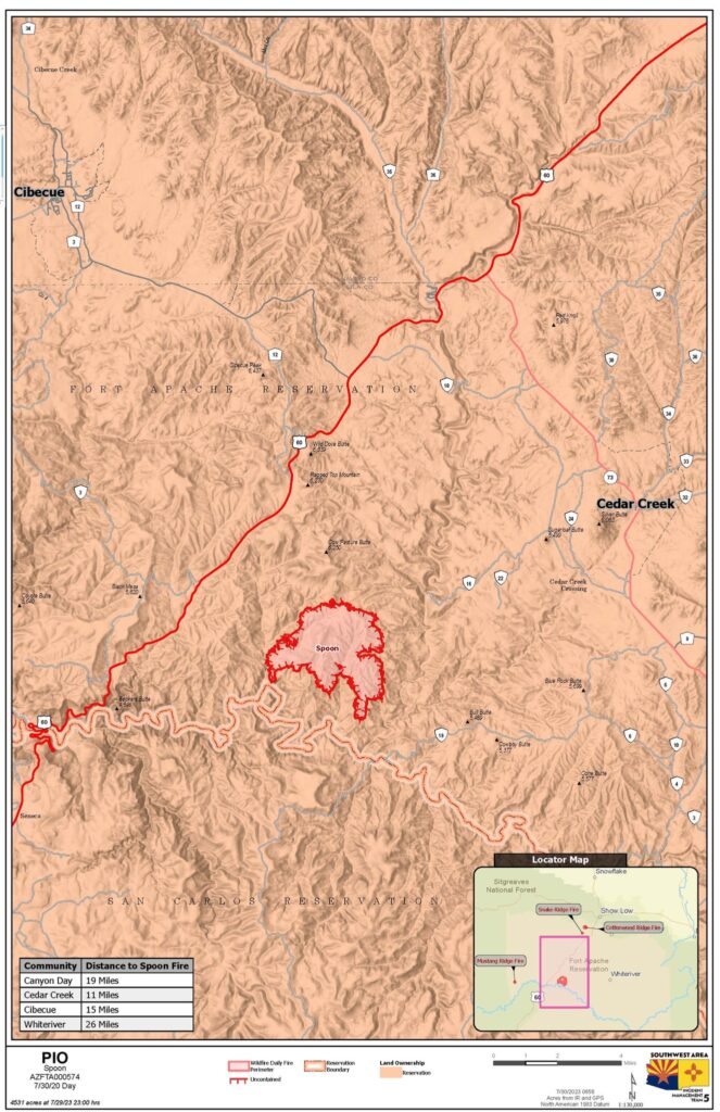
Spoon Fire Quick Facts
Acres: 4,560 acres
Cause: Lightning
Containment: 25% Start Date: July 24, 2023
Location: 2.5 miles east of Highway 60 between Globe and Show Low, AZ. 11 miles southwest of Cedar Creek
Fuels: Piñyon- Juniper, Manzanita, Grass, Cedar
Snake Ridge Fire Quick Facts
Acres: 42 acres
Cause: Lightning
Containment: 25% Start Date: July 28, 2023
Location: 11 miles southwest of Show Low, AZ.
Fuels: Grass, Brush
Total personnel for all incidents: 392
The last several days of rain and higher humidity have kept fire activity minimal. Hotspots may still exist, and some areas may become active again toward the end of the week as fuels dry out. Lightning in the area has ignited at least one snag, and firefighters will be on the lookout for additional new starts. The rain and humidity will help fuels absorb moisture, which can reduce the chance of rapid fire growth.
Cottonwood Ridge Fire Update: Crews continue to improve firelines, mop up areas, and seek out hotspots. Hotspots can be more difficult to find because of the recent rains and lack of smoke. Work will continue around the northern edge of the fire, as weather conditions allow.
Spoon Fire Update: The Spoon Fire received the least amount of rain on Monday, as weather systems moved into the area around 5 p.m. This allowed firefighters to make progress on fireline construction. Air resources were mostly grounded due to weather storms in the area. Crews will continue to construct and secure fireline using hand crews and dozers, focusing on the west and south edges. The southern portion of the fire will have the highest chance of showing heat again as the weather warms and dries heading into Thursday and Friday this week.
Snake Ridge Fire Update: Crews were able to make some progress on mop up and line securing operations before being pulled from the line due to weather on Monday. Firefighters will continue to seek out hotspots and secure fire line to increase containment.
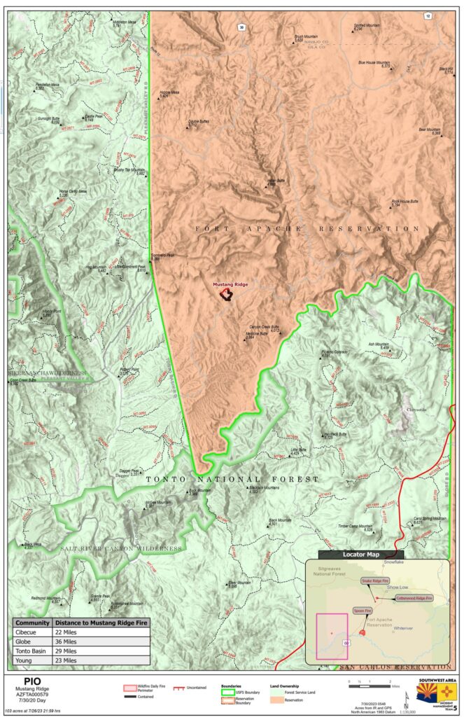
Mustang Ridge Fire Update: The Mustang Fire has reached 100% containment and will continue to be monitored by air.
Weather: On Monday, multiple storm systems moved into the area with rain falling over both the Cottonwood Ridge and Snake Ridge fires helping fuels to absorb moisture. This weather system is expected to continue on Tuesday, which will help keep fire activity minimal and decrease the chances of fire activity increasing when the area begins to dry out again at the end of the week.
Evacuations: None.
Residents and visitors should take time to become familiar with the Ready, Set, Go evacuation model. These steps help you to be READY in the event of an emergency by preparing now. Additionally, sign up for the Navajo County Alert System at https://tinyurl.com/y4vwrasw.
Smoke: Rain and humidity area keeping fire behavior to a minimum and there is no smoke currently visible. This may change as the area dries out as the week progresses. The Spoon Fire may have isolated pockets of heat and smoke. Please slow down when traveling through smoky areas.
For information on smoke and air quality visit https://www.airnow.gov.
Closures: Highway 60 remains open. The southwest portion of Fort Apache is closed, including all Salt River sites within the closure area.
Fire Restrictions: There are several fire restrictions in place depending on location.
Fort Apache Agency: Stage 2 Fire Restrictions. No campfires, fireworks, outdoor smoking, debris burning or discharging of firearms. Power saws cannot be used between 10 am and 8 pm. All motorized travel is restricted to developed roads.
Show Low, Navajo County and Apache Sitgreaves National Forests: Stage 1 Fire Restrictions. No campfires (except in developed recreation sites), no smoking outdoors, no welding, no fireworks.
For more Information:
Inciweb:
Cottonwood Ridge: https://inciweb.nwcg.gov/incident-information/azfta-cottonwood-ridge-fire
Spoon: https://inciweb.nwcg.gov/incident-information/azfta-spoon-fire
Facebook: https://www.facebook.com/BIAFAAFireMgt/