Public Information Line: 928-205-5752
Firefighters Reassigned to New Fires as Containment Increases
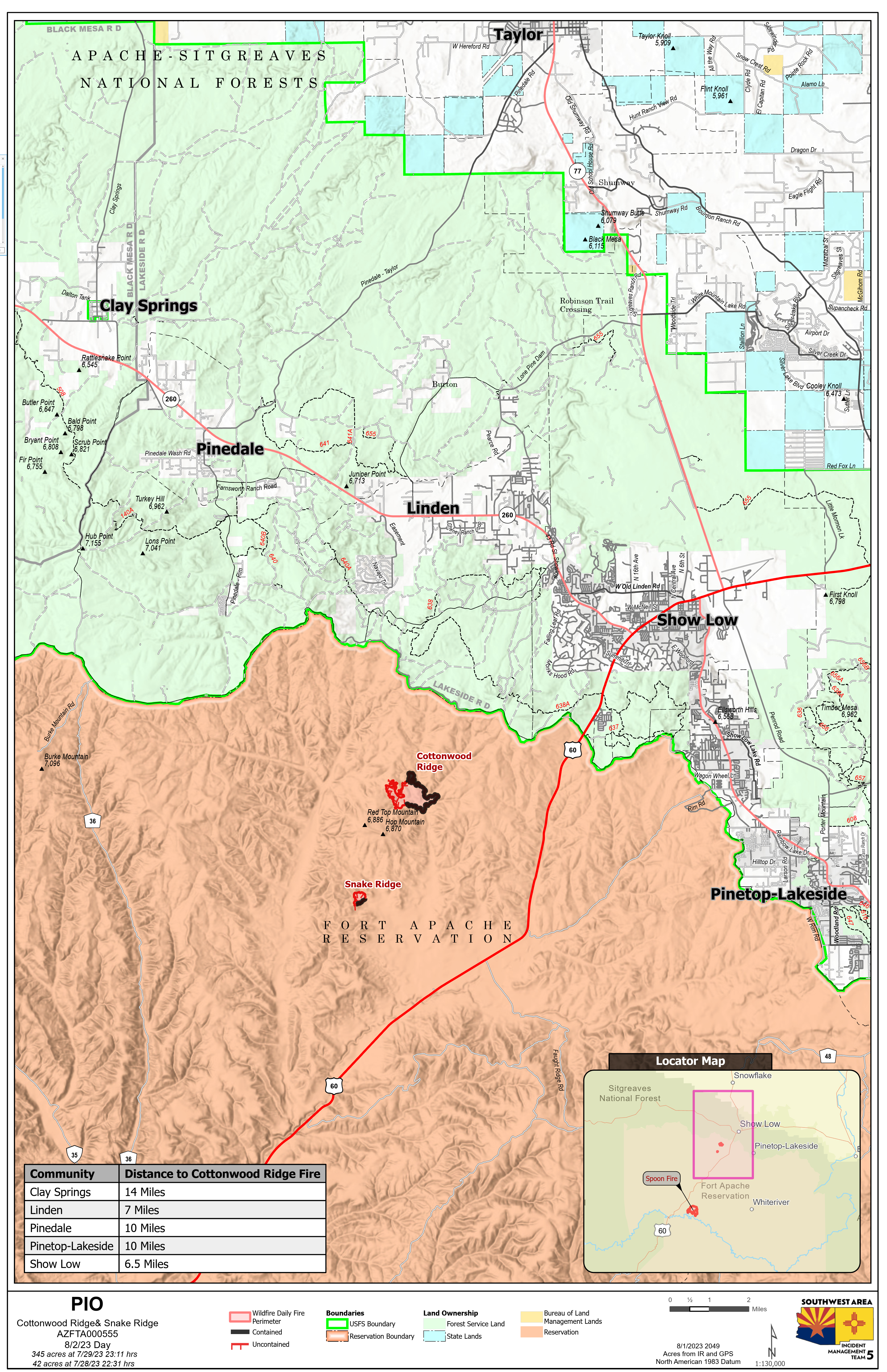
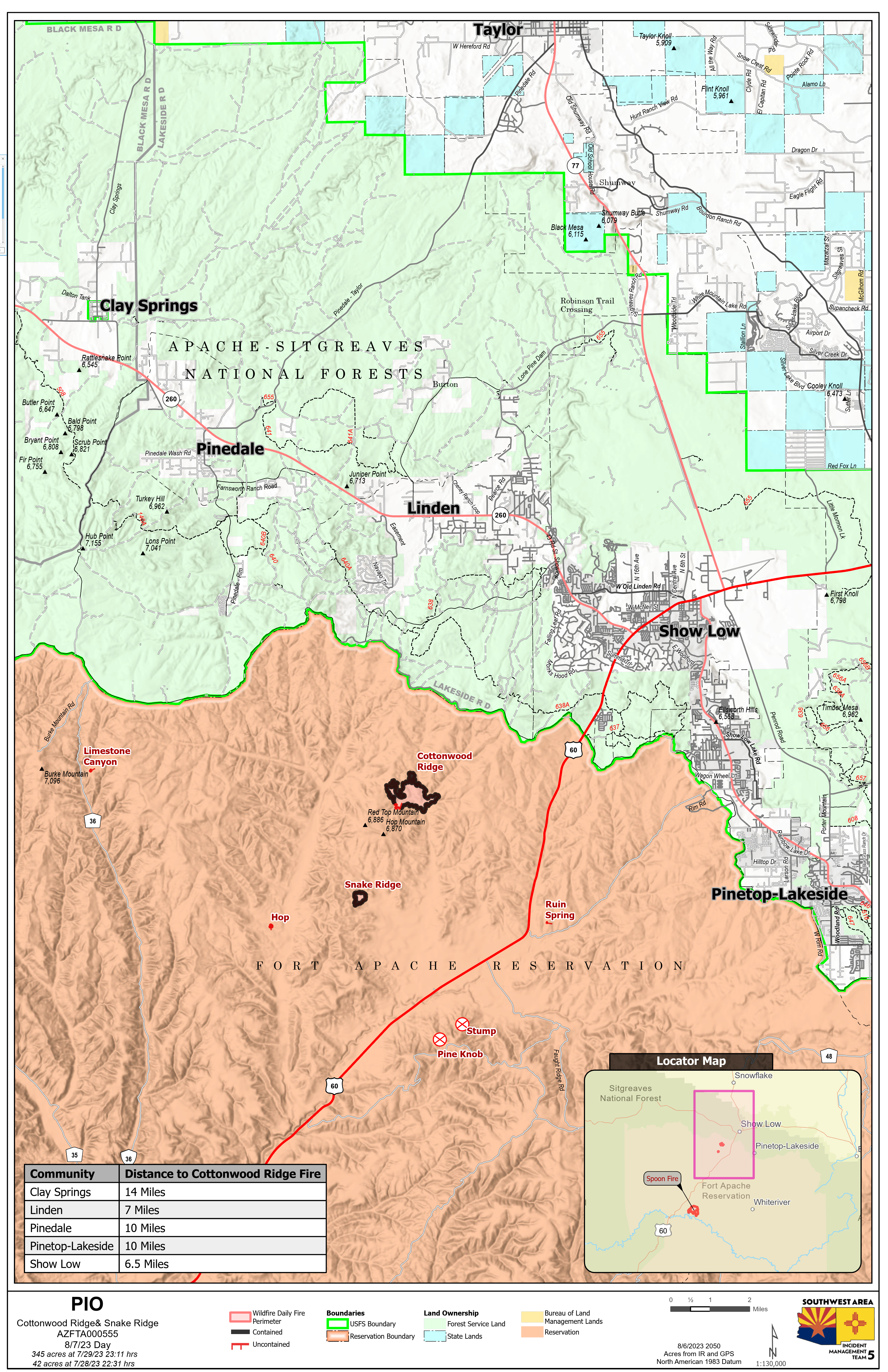
Cottonwood Ridge Fire Quick Facts
Acres: 345 Cause: Lightning Containment: 95% Start Date: July 23, 2023 Location: 4 miles south of Show Low, AZ Fuels: Timber, grass, brush
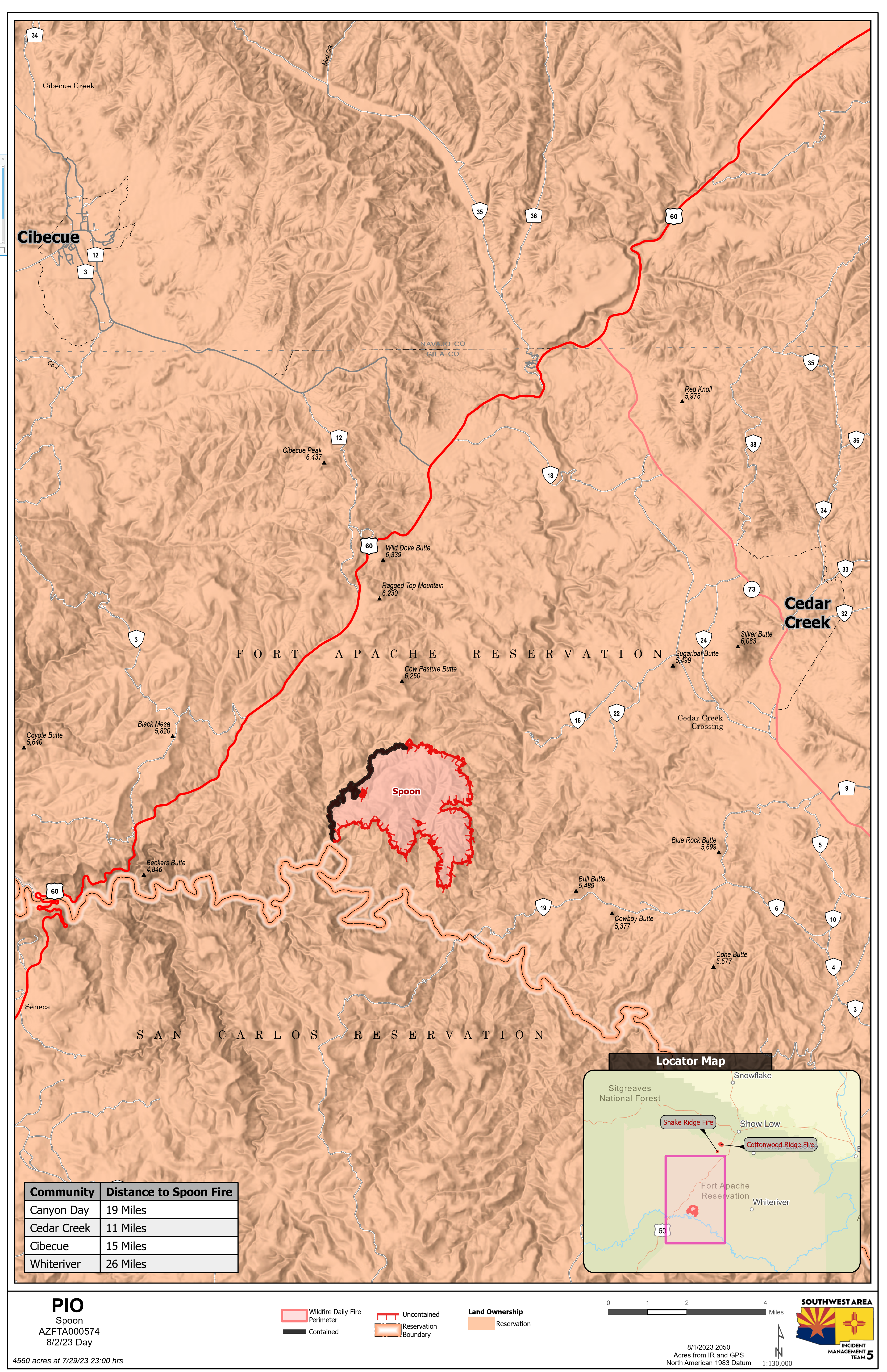
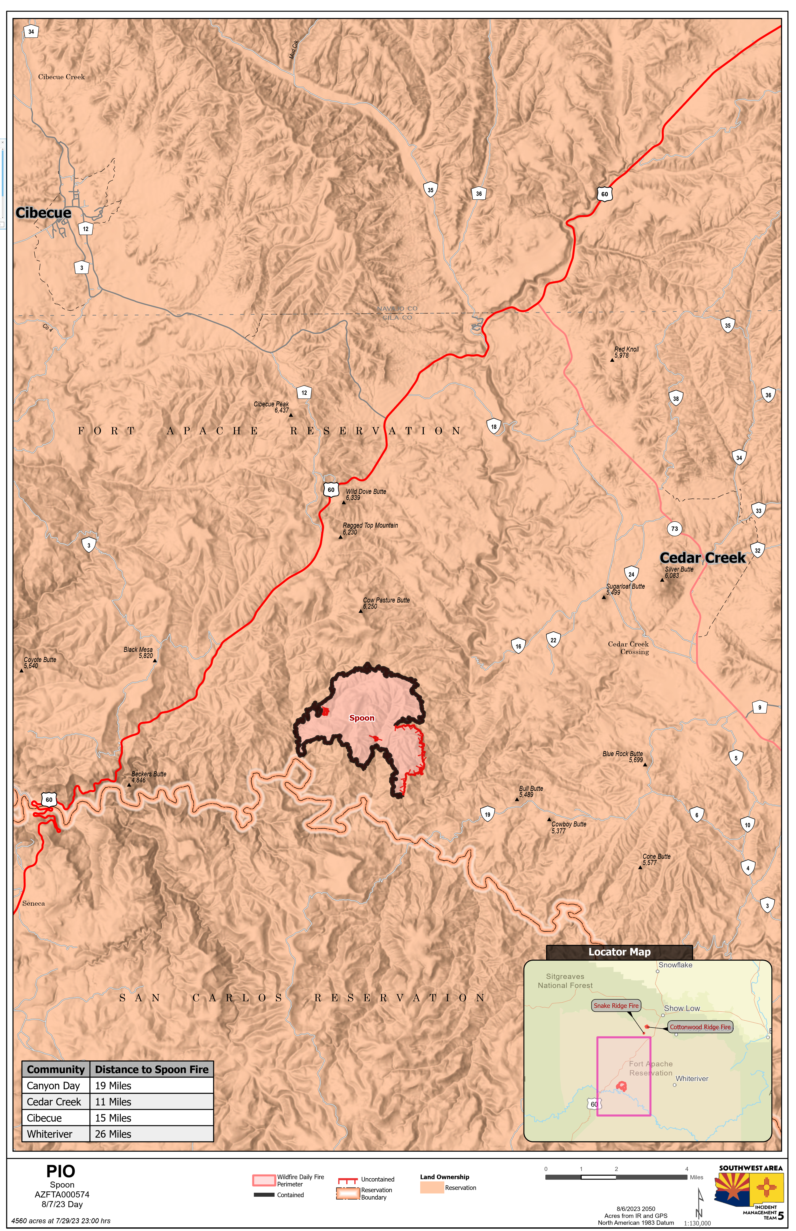
Spoon Fire Quick Facts Acres: 4,560 acres Cause: Lightning Containment: 80% Start Date: July 24, 2023 Location: 2.5 miles east of Highway 60 between Globe and Show Low, AZ. 11 miles southwest of Cedar Creek Fuels: Piñyon- Juniper, Manzanita, Grass, Cedar
Total personnel for all incidents: 232
Sunday, the weather remained hot and dry with winds gusts up to 20 mph. Crews continued to repair the containment lines by turning over dirt to make sure there were no hot spots near the fire’s edge. The Spoon Fire is 80% contained, and the Cottonwood Ridge fire remains at 95% contained. There were no new fires reported on Sunday. Crews continued mopping up the fire on Chediski Mountain. A hand crew and a dozer worked around the perimeter looking for hot spots and heat sources.
Cottonwood Ridge and Spoon fires: The excavators and hand crews continued repairing dozer lines and returning the land back to its natural state. On the Cottonwood Ridge fire crews are about 50% done with the repair process. Crews on the Spoon fire worked back up the hill from Carrizo Creek repairing the dozer line and have completed about 75 % of the work that needs to be completed.
Weather: The forecast for Monday calls for a 50% chance of thunderstorms and a possibility of new lighting strikes. Firefighters will remain prepared to respond to any new fire starts.
This will be the last update for Southwest Area Incident Management Team 5. The team will be turning management of these fires back to the Fort Apache Agency. The team would like to give a big thank you for allowing us to come into your community and we appreciate the warm welcome we received.
For More Information: For further updates regarding fires on the Fort Apache Reservation, please visit: Facebook: https://www.facebook.com/BIAFAAFireMgt/
More Information: For further updates regarding fires on the Fort Apache Reservation, please visit: Facebook: https://www.facebook.com/BIAFAAFireMgt/