Cottonwood Ridge Fire update 7-26-2023

This morning City and County Officials met to continue strategic planning and communication pertaining to the Cottonwood Ridge Fire burning near Show Low. As the BIA-Fort Apache agency shares an update, we will provide the information.

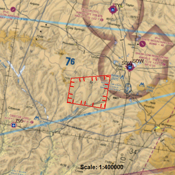
To ensure the safety of the air crews fighting the fire there is a no-fly zone around the area, including drones. If there are unauthorized flights in the area, air attack on the fire will be immediately shut down thus creating unnecessary risk to the community.

For the safety of the public and fire personnel who are actively building a buffer zone, law enforcement has established a road closure on the Rim Road (FS300) at Hwy 60, Rim Rd at Juniper Ridge and 1.5 miles south of Hwy 260 on Joe Tank Rd.

The Ready, Set, Go program has been established to ensure the public safety in evacuations for all hazards, including wildfire. This is a reminder that every household should be in READY status at all times. For more information visit https://ein.az.gov/ready-set-go

We highly encourage our community members, both part-time and full-time, to subscribe to the Ready Navajo County alerting system at https://member.everbridge.net/453003085612436/login

We ask that our community members utilize only vetted sources of information on this incident and any future emergencies. Information and updates can be found at the Navajo County Emergency Management and Preparedness Facebook page and 311info.net.

We again thank the BIA-Fort Apache agency and any other tribal suppression resources for their continued effort in fighting this fire. We also thank the U.S. Forest Service and AZ Department of Forestry and Fire Management for their continued support. We continue to extend gratitude to our community leaders for their proactive and assertive approach in ensuring our communities safety.

Lastly, thank you to the citizens of Navajo County for your continued support of our public safety members and officials.

Cottonwood Ridge Fire

July 25, 2023
Whiteriver, AZ – The Cottonwood Ridge Fire started on Sunday, July 23, 2023 within the old Rodeo-Chediski burn scar on the Fort Apache Indian Reservation. It is approximately 240 acres, burning mainly dead and down logs and manzanita in steep and rugged terrain that is difficult for firefighters to access. The Cottonwood Ridge is exhibiting low to moderate fire behavior.
Yesterday, Airtankers have slowed the fire’s growth using retardant while firefighters were scouting to gain access to the fire. There were 23 personnel on the fire yesterday with additional resources on order.
Management Objective: Reduce fire size using aircraft, giving firefighters time to assess the fire landscape. Firefighters are working on full suppression tactics for this fire.
Operational Update: Today, firefighters will continue to scout the area to gain access to the south end of the fire to establish an anchor point. Heavy equipment will improve the main road. Air resources will continue to support the fire.
Safety: The health and safety of firefighters and the public are always the priority. Members of the public should avoid the fire area.
Values at risk: Potential communities at risk include Linden to the north of the Cottonwood Ridge Fire, but it’s NOT an immediate threat at this time. Citizens should always be “Ready” for any emergency by having a kit, being on the Ready Navajo County Alert System (sign up here: https://member.everbridge.net/453003085612436/login) and watch official sources for accurate information. Should the need arise to go into “SET”, an alert will be sent, as well as posts added to our social media and on www.311info.net. Highway 60 may be impacted and is located east of the fire.
Smoke: Go to https://fire.airnow.gov/ to see the latest smoke conditions in your community. Smoke may be visible from the surrounding communities and along Highway 60.
Primary and Cooperating Agencies: Bureau of Indian Affairs, White Mountain Apache Tribe, Navajo County, and US Forest Service.
#

Cottonwood Ridge Fire

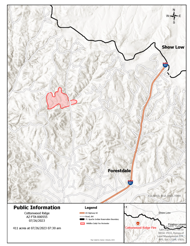
The Cottonwood Ridge Fire started on Sunday, July 23, 2023 within the old Rodeo-Chediski burn scar. It is approximately 70 acres, in steep and rugged terrain that is difficult for firefighters to access. The fire is located about 10 miles southwest of Show Low. Fire resources include a Type 3 Helicopter, a dozer and Fort Apache Fuels Crew. Fire resources are working on tactics to fully suppress this fire. Smoke will be visible in surrounding areas.