
 KEY POINTS
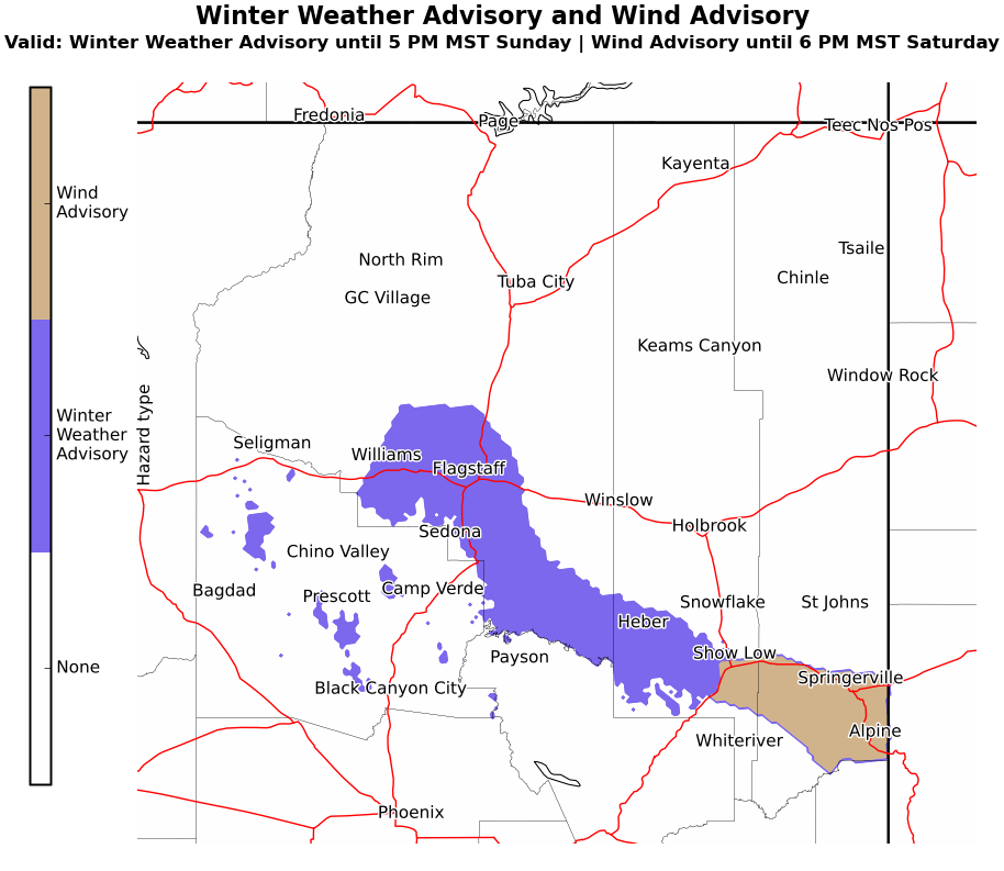
● Winter Weather Advisory for portions of the Mogollon Rim and Yavapai county above 6000 feetthrough 5 PM MST Sunday.
● Wind Advisory for the north facing slopes of the White Mountains until 6 PM MST Saturday.
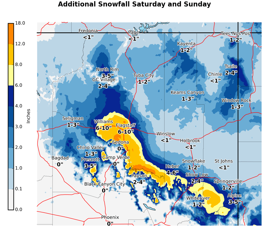
● Weekend storm primary impacts are mainly above 5000-6000 feet.
● Showers become sporadic today, increasing again tonight in the Winter Weather Advisory area.
● 6 to 12 inches above 6000 feet this weekend, with lesser amounts above 5000 feet by Sunday.
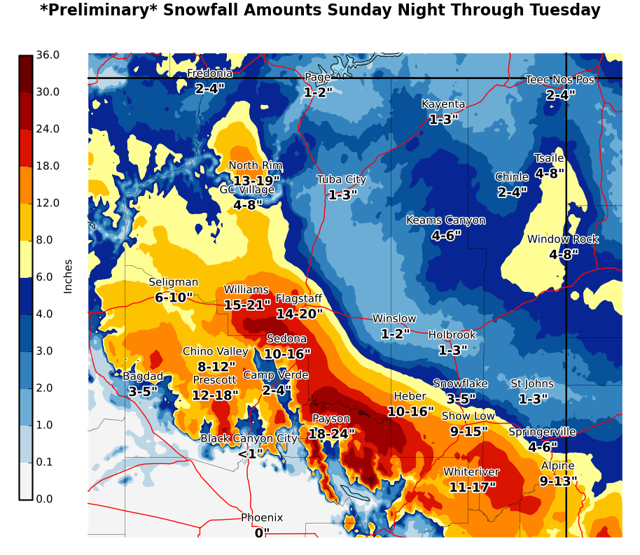
● Monday/Tuesday storm impacts will affect nearly all locations above 2000-3000 feet and will bring accumulating snow to a large portion of northern and central Arizona.
● 10 to 20 inches above 4500-5000 feet Monday and Tuesday, amounts of 10 inches or less down to elevations as low as 2500-3000 feet. Potential for heavy snow loads between 4000-5000 feet.
IMPACTS
● Difficult to impossible travel conditions at times, due to heavy snow.
● Spotty power outages due to heavy snow and gusty winds.
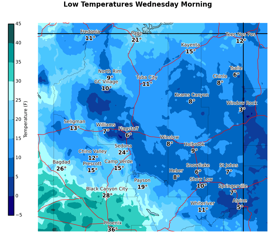
● Bitter cold Wednesday and Thursday morning may cause external pipe damage and frozen pipes.
Winter Storm Warning was downgraded to a Winter Weather Advisory on Friday afternoon. Wind Advisory added for the north facing slopes of the White Mountains for Saturday.