
![]() Springerville, AZ – Feb. 16, 2021 — The Black Mesa Ranger District on the Apache-Sitgreaves National Forests will be conducting a prescribed burn within the Black Mesa Administration Site Prescribed Burn area starting today, Tuesday, February 16th, due to favorable weather conditions.
Springerville, AZ – Feb. 16, 2021 — The Black Mesa Ranger District on the Apache-Sitgreaves National Forests will be conducting a prescribed burn within the Black Mesa Administration Site Prescribed Burn area starting today, Tuesday, February 16th, due to favorable weather conditions.
The Black Mesa Administrate Site piles, approximately 5 acres, are located at the Black Mesa Ranger District in Overgaard. Fire crews will be on scene from the beginning of ignitions until there is no longer a threat of escape from the project boundaries.
Prescribed burning provides many benefits and is essential to maintaining healthy forest ecosystems. This prescribed fire is a follow-up to previous hand thinning treatments within the unit. It provides habitat diversity, recycles plant nutrients into the soil, and encourages new growth for various plants used by wildlife and livestock. Prescribed burning of forest ground fuels also reduces the threat of large-scale wildfire impacts on private lands.
Smoke will be visible from HWY 260, 277, 377, and the communities of Heber-Overgaard, Aripine and Clay Springs. All prescribed burns are approved through the Arizona Department of Environmental Quality (ADEQ) before ignitions begin. ADEQ monitors air quality and determines whether or not it will be a good day for smoke dispersion.
Although smoke from prescribed fire can still be a nuisance, it is usually for a shorter time and considerably less smoke than wildfires produce. If you are sensitive to smoke or have respiratory problems, stay indoors if possible. To find helpful resources visit the Apache-Sitgreaves National Forests website at www.fs.usda.gov/detail/asnf/fire.
The public can obtain additional information via the following:
• Local Ranger Station: Black Mesa RD (928) 535-7300
• 311 Information at (928) 333-3412
• Apache-Sitgreaves National Forests website at www.fs.usda.gov/asnf
• Twitter: twitter.com/A_SNFs
• Facebook: www.facebook.com/apachesitgreavesnfs/
###
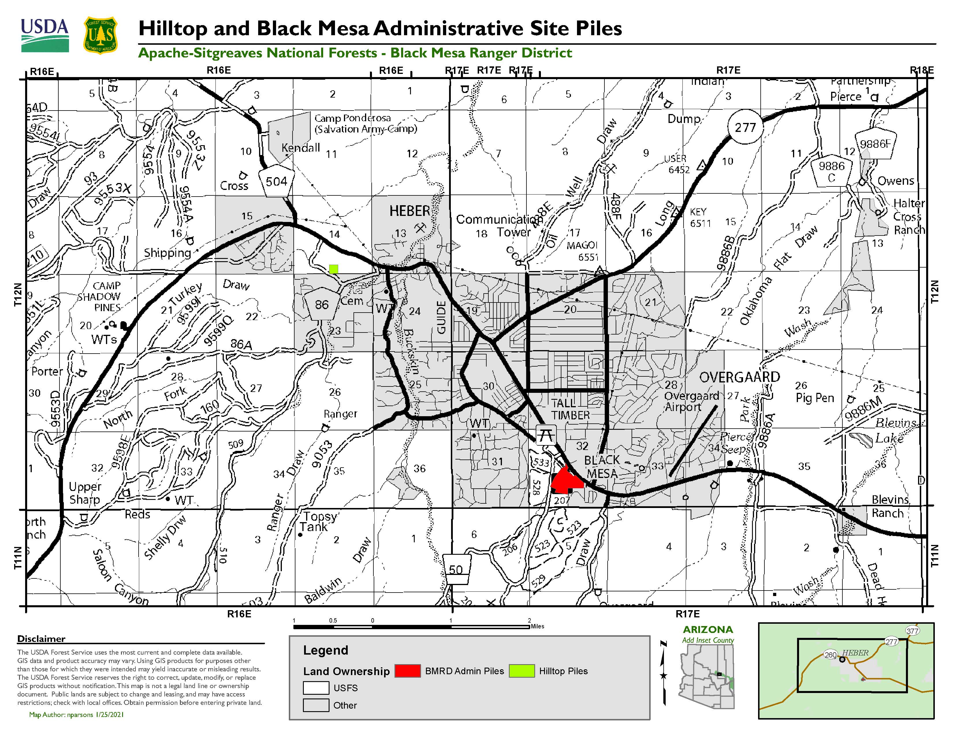 SPRINGERVILLE, AZ,- January 26, 2021 – The Black Mesa Ranger District on the Apache-Sitgreaves National Forests will be conducting a prescribed burn of piles on two administrative sites starting Wednesday, January 27, lasting through the end of the week, as weather conditions allow. The sites are called the Hilltop and Black Mesa Administration Site Prescribed Burn areas.