
 9/22/16 9:36 am
Southwest Area Incident Management Team #1 – Bea Day, Incident Commander
FULTON FIRE UPDATE 9/22/2016
Location: 28 miles east of Payson, AZ – South of State Highway 260
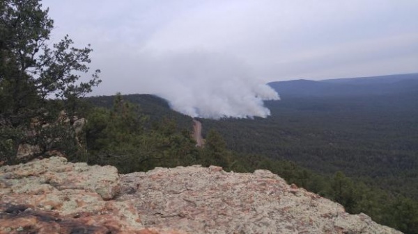
Size: 1,736 acres
Total Personnel: 361, including 9 Hand Crews, 14 Engines, 2 Bull Dozers
Containment: 51%
Strong Gusty Winds Expected Today
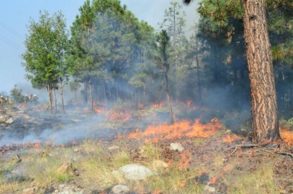
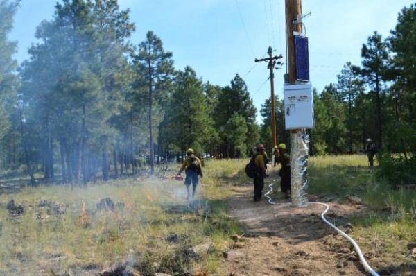
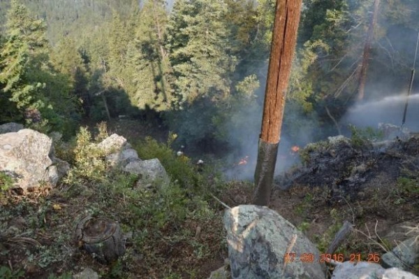
Update: The fire displayed minimal activity through the day on Wednesday, allowing crews valuable time to reinforce fire line in anticipation for today’s wind event. Last night firefighters continued to patrol the fire to prevent movement outside of pre-established containment lines. The fire growth reflected in today’s statistics is attributed to improved information gathering resulting in better mapping of the incident area. There was very little actual change in the size of the fire affected area.
Weather: A chance of showers and thunderstorms and higher relative humidity are expected to continue into Friday morning. A frontal passage will occur late today into early Friday, resulting in strong and gusty winds, as well as the wind direction switching from the south to southwest ahead of the front. Dry and warmer conditions are expected over the weekend and into early next week as high pressure aloft builds over the southwestern United States.
Overview: The Fulton Fire was ignited by a lightning strike early Monday, September 12 mid-slope along the Mogollon Rim near the Mogollon Rim Visitor’s Center. Firefighters are fully suppressing the fire as they can do so safely and effectively to help protect local communities, powerlines, recreation sites, travel corridors, wildlife habitat and timber sale areas. They will use a range of tactics to minimize firefighter and public risk and promote forest health. Low intensity fire will be used to minimize smoke impacts.
Firefighters are using existing road and trail systems to contain the north side of the fire. Firefighters plan to keep fire within the perimeter of the 2009 Bachelor Fire using previously established fire control lines on the southeast side of the fire. On the south side of the fire, firefighters are using fuel treatment barriers and established control lines.
Community Meeting: The Fulton Fire Incident Management Team and Gila County Emergency Management are hosting a community meeting today, September 22, at 4 pm at the LDS church in Christopher Creek. Fire personnel will provide an overview on fire activity and plans for management operations for the coming days. An American Sign Language interpreter will be on site.
Fire Information: For additional fire information, visit http://inciweb.nwcg.gov/incident/5031/ or follow @TontoForest on Twitter at https://twitter.com/tontoforest. An interactive fire map can be found at: http://bit.ly/FultonFireMap. If you wish to be on our mailing list for updates or have questions, you may contact us at FultonFireInfo@gmail.com or call (505)750-4636 from 8:00 a.m. to 8:00 p.m.