
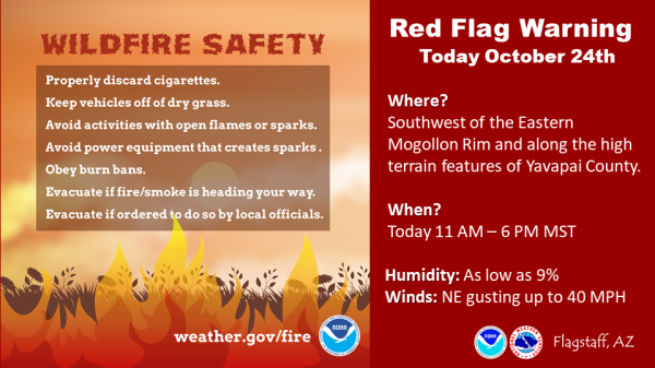
A Red Flag Warning is in effect for parts of Navajo County for October 24, 2019
Reply

Fort Apache Agency continues to conduct prescribed burning on the Fort Apache Indian Reservation. Since October 9, 2019, a total of 4,864 acres has been treated within five burn units. Fire personnel will conduct prescribed burn treatments within the Odart and Turkey Creek burn units.
The Odart burn unit is located about 18 miles southeast of Whiteriver. Today, October 21, 2019, fire personnel will conduct broadcast burning operations within this burn unit. If conditions are favorable they will continue treatment efforts within this burn unit for the next few days.
The Turkey Creek burn unit is located about 8 miles east of Whiteriver. Today, October 21, 2019 fire personnel are conducting broadcast burning operations within this burn unit. If conditions are favorable they will treat over 500 acres within this burn unit.
Nearby residents should expect smoke in the vicinity and drivers should pay extra attention while traveling through or adjacent to burn areas. All Prescribed Fire activity will be carefully monitored and will comply with smoke management guidelines to reduce the impact of smoke on local residents. If conditions become unfavorable prescribed burning efforts will be ceased to mitigate smoke impacts to the communities.
Prescribed burning efforts will continue as long as weather conditions permit and targeted acres are completed. The next update will be on Monday, October 28, 2019.
If you have any questions regarding our upcoming prescribed burning efforts, you can call Candy Lupe, Public Information Officer at (928) 338-5425 or you can log onto BIA Fort Apache Agency’s Facebook page, https://www.facebook.com/BIAFAAFireMgt.
FLAGSTAFF, Ariz., Oct. 18, 2019 — With the weather staying temperate and dry, Coconino National Forest firefighters are planning to conduct prescribed burns next week near the Fort Valley area and Clints Well area if weather conditions and staffing remain favorable.
These burns are among the prescribed burn projects planned for the Flagstaff Ranger District and the Mogollon Rim Ranger District this fall and are part of a strategy to allow fire across the landscape in order to restore forests to healthier conditions, protect watersheds and improve the safety of the communities around them.
Frequent, low-intensity fire removes accumulated smaller fuels and recycles nutrients in the soils to promote healthy vegetation and wildlife habitat. A healthier forest is a safer forest for firefighters and residents when wildfires inevitably occur.
The prescribed burn projects listed below are in chronological order. Firing ignitions for each of these projects begin at approximately 10 a.m. on the mornings indicated.
Cragin Watershed Protection Project
• When: Monday (Oct. 21), determined by conditions and staffing.
• Where: 1.5 miles south of Blue Ridge Ranger Station. GPS: 34.582733, -111.174404
• Size: 300 acres
• Duration: This is a one-day operation.
• Method/Type of Burn: Broadcast maintenance burn conducted by drip torch. This burn will reduce the chance of catastrophic wildfire, improve forest health, and protect the local watershed. Since this is an initial-entry burn, smoke will be thicker and more noticeable than a maintenance burn due to the amount of forest fuels in the burn area.
• Smoke Impacts: Ventilation is predicted to move smoke toward the northeast. Smoke impacts are expected for Blue Ridge communities, Winslow, Holbrook and state Route 87. Cooling temperatures in the evenings will cause smoke to settle in the low-lying areas surrounding Blue Ridge and the Moqui Draw.
• Closures/Restrictions: None expected.
Experimental Forest
• When: Tuesday (Oct. 22).
• Where: Six miles northwest of Flagstaff. GPS: 35.272710, -111.691766.
• Size: 525 acres.
• Duration: This is a one-day operation.
• Method/Type of Burn: Broadcast maintenance burn conducted by drip torch. This burn is being conducted for fire research purposes and in partnership with NAU, Ecological Restoration Institute, and The Nature Conservancy in order to measure things such as pine regeneration, tree mortality, and other factors associated with wildfire in this fire-dependent ecosystem.
• Smoke Impacts: Ventilation is predicted to move smoke toward the northeast and may impact U.S. Highways 180 and 89 north of Flagstaff. Cooling temperatures in the evenings may cause smoke to settle in the low-lying areas of Ft. Valley Ranch, Cheshire, and possibly Baderville.
• Closures/Restrictions: None expected. However, Arizona Department of Transportation (ADOT) will likely reduce the speed limit on Hwy 180 and impose lane restrictions where needed.
Slate 4
• When: Wednesday (Oct. 23).
• Where: 16 miles north of Flagstaff. GPS: 35.446216, -111.703208.
• Size: 2,528 acres.
• Duration: One-day operation.
• Method/Type of Burn: Broadcast initial-entry burn conducted by drip torch and helicopter. This burn is located in a strategic area to protect Kendrick Park, White Horse Park and Snowbowl Estates by removing dense forest fuels that could endanger the communities if a severe wildfire started in the area.
• Smoke Impacts: Ventilation is predicted to move smoke toward the northeast. Cooling temperatures in the evenings will cause smoke to settle in the low-lying areas surrounding the burn and White Horse Canyon. This will likely impact U.S. Highways 180, 89, Kendrick Park, White Horse Park and Snowbowl Estates. Since this is an initial-entry burn, smoke will be thicker than normal.
• Closures/Restrictions: None expected.
Sawmill Project
• When: Wednesday (Oct, 23) or Thursday (Oct. 24).
• Where: Six miles south of Mormon Lake Village. North of Stoneman Lake Road on the immediate east side of Lake Mary Road. GPS: 34.8177200, -111.4269700
• Size: 800 acres
• Duration: This is a one-day operation.
• Method/Type of Burn: Broadcast maintenance burn using drip torches. The burn is being conducted to reduce the chance of catastrophic wildfire, improve forest health, and to protect the private property and help the health of the forest.
• Smoke Impacts: Daytime winds are predicted to be out of the southwest, so smoke will disperse to the northeast of the project area. Cooling temperatures in the evenings will cause smoke to settle in the low-lying areas near Hutch Mountain.
• Closures/Restrictions: None expected. If smoke is on Lake Mary Road, traffic control may be used.
Maxwell Springs 1 & 2
• When: Thursday (Oct. 24).
• Where: Five miles northwest of Flagstaff. GPS: 35.250812, -111.824213 & 35.263236, -111.806195
• Size: 833 acres total in two burn blocks.
• Duration: One-day operation.
• Method/Type of Burn: Broadcast maintenance burn conducted by drip torch. These burns are located south of Wing Mountain and north of Bellemont.
• Smoke Impacts: Ventilation is predicted to move smoke toward the northeast. Cooling temperatures in the evenings will cause smoke to settle in the low-lying areas surrounding the burn, Interstate 40 and the west side of Flagstaff. This will likely impact Fort Valley, Snowbowl Ski Resort area and possibly U.S. Highway 180.
• Closures/Restrictions: None expected.
Notifications of upcoming prescribed burns are provided regularly by news releases throughout the season. Timely updates about ignitions and whether or not a project is cancelled can be found on the Forest’s social media sites:
• Coconino NF’s Twitter account
• Coconino NF’s Facebook page