![]()
 The White Mountain Zone Type 3 Team has been ordered for the Incident and will assume command of the G22 Fire, at 6:00 a.m. tomorrow morning, April 8 2021.
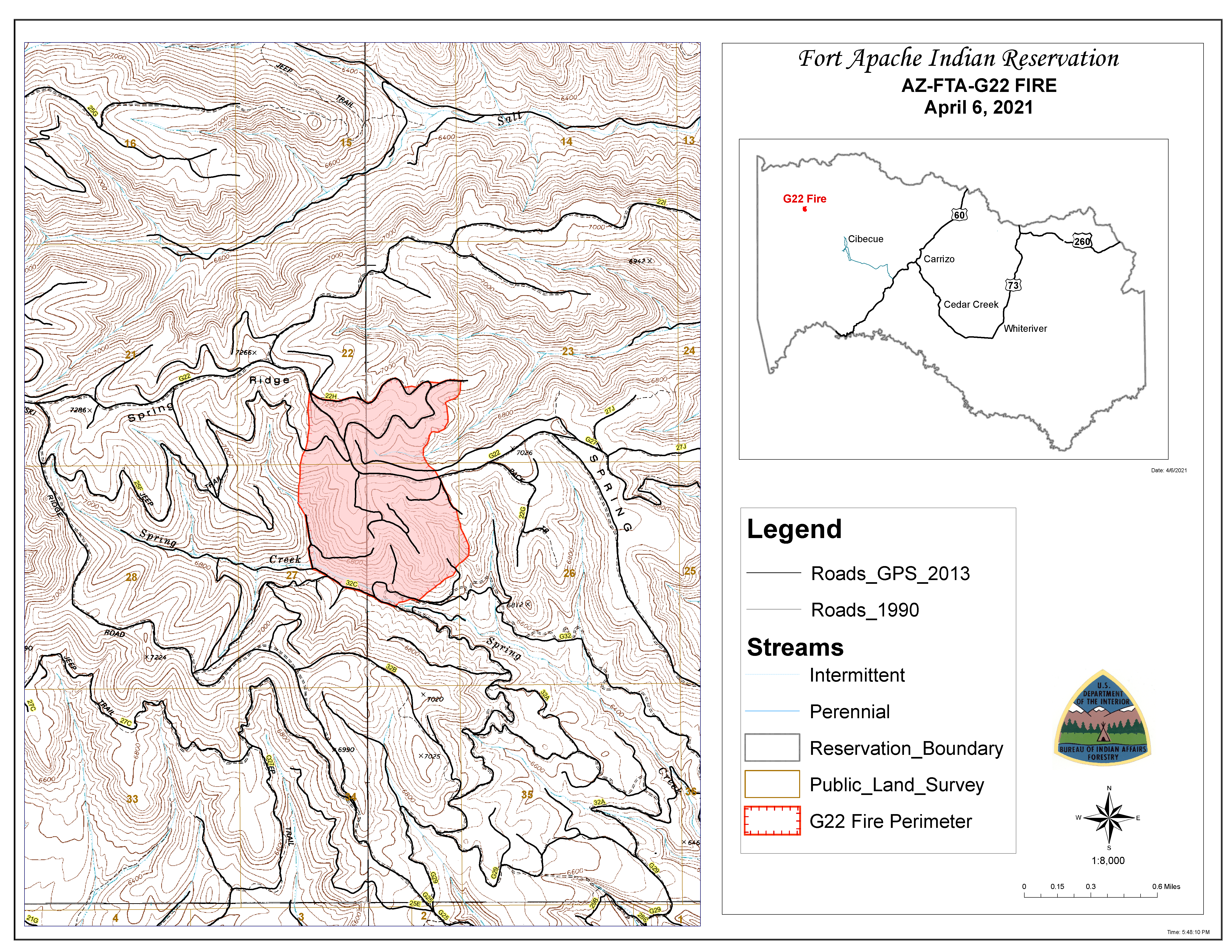
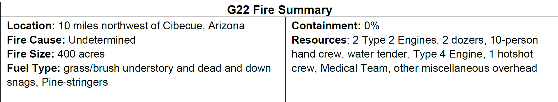
Fire Activity and Operations: Yesterday, the fire cross one of the contingency lines within the northeast flank of the fire. Fire personnel conducted burnout operations along the 22H road to the G22 junction to keep the fire in check. There was minimal movement on the south flank of the fire.
Today, fire personnel will build indirect/direct handline in the southeast flank of the fire working along Spring Creek to the 32C junction. The roads within and surrounding the fire will continued to be cleared for access.
Road Closures: The junction of the 27/28 road, north of Grasshopper Ranch and Salt Creek north of Chediski Lookout is closed due to fire activity.
Values and Objectives: Firefighter and public safety is the number one priority for the G22 Fire. All fire actions will be assessed in relation to protecting values and minimizing impacts on cultural resources, wildlife, rangeland, watersheds, and natural resources.
If you have any questions regarding the fire, you can call Candy Lupe, Public Information Officer at (928) 205-5662 or you can log onto BIA Fort Apache Agency’s Facebook page, https://www.facebook.com/BIAFAAFireMgt.