Mescal and Telegraph Fires Smoke Forecast 6/13/2021

The Telegraph fire grew by around 1,000 acres yesterday, bringing the total acreage to just over 88,000. The majority of the growth/smoke was from fire on Signal Peak.

Smoke Synopsis

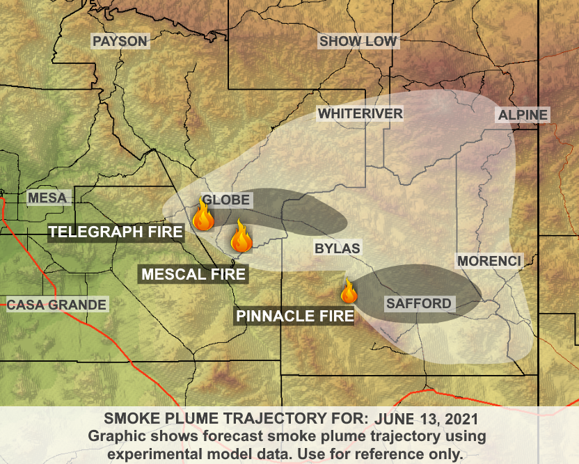
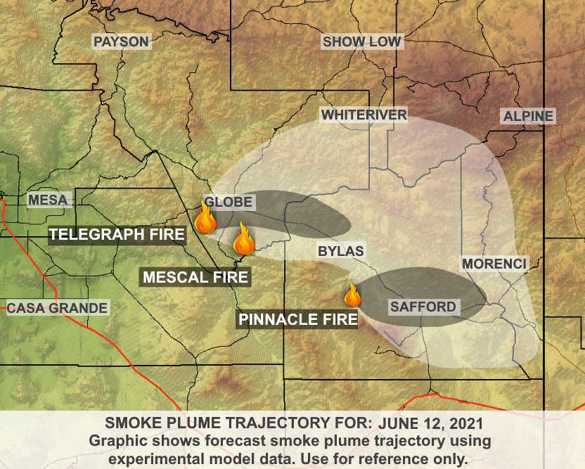
Today (Sunday), smoke production and dispersion is expected to be very similar to what was seen yesterday, with smoke dispersing toward the east at/just above the surface and more toward the east-northeast for smoke that is lifted slightly higher up into the atmosphere. With strong surface heating, expect smoke to get plenty of lift. As a result, we are only forecasting light to brief moderate smoke impacts to the Globe area, San Carlos, and Peridot. There is also a chance smoke will move over locations in/around Whiteriver and Eagar; however, impacts at the surface are expected to remain light.

Further east, Fort Thomas and Safford may experience light to moderate smoke from the Pinnacle Fire, burning west of the area in the Pinaleno Mountains (near Santa Teresa Wilderness). Once again, with good lift during the day, impacts should not be long-lived. The fire is currently around 6,300 acres with approximately 3,000 acres of growth yesterday.

Tomorrow, as high pressure begins to shift eastward toward the Four Corners, smoke may begin to move westward over Queen Valley and over portions of the Phoenix Valley.

Also of note, regional smoke from fires in Mexico is slowly moving northward into Arizona as it wraps clockwise around the high pressure in New Mexico. While this smoke is expected to remain mostly elevated off the ground, it may result in hazy conditions across the state.

Mescal and Telegraph Fires Smoke Forecast 6/12/2021

The Telegraph fire is now around 87,000 acres, and for the second day in a row, no new perimeter growth on the Mescal Fire, which has been mapped at 72,196 acres.

Smoke Synopsis

Weather and smoke conditions Saturday and Sunday are expected to be very similar to what was seen on Friday. Smoke is forecast to slowly disperse toward the east both days. This means light to moderate impacts will once again be possible throughout the day in/around Globe, San Carlos, and Peridot.

With the light winds, not expecting smoke to disperse as far as we saw last weekend into the first part of next week; however, during the heat of the day, smoke that becomes slightly higher up in the atmosphere is forecast to move toward the northeast. There is a slight possibility smoke could move over areas in/around Whiteriver and Eagar this afternoon; however, impacts at the surface are expected to be light.

Further east in Safford, smoke from the Telegraph may combine with smoke from the Pinnacle Fire, burning west of the area in the Pinaleno Mountains (near Santa Teresa Wilderness). As a result, the region in/around Safford may experience light to moderate smoke throughout the day into the overnight hours.

Mescal and Telegraph Fire Forecast 6/11/2021

The Telegraph Fire has burned approximately 86,400 acres, with around 550 acres of growth yesterday. The perimeter size of the Mescal Fire did not change yesterday, coming in at about 72,000 acres.

Thanks to excellent work by firefighters, smoke production over the past couple of days on the Telegraph and Mescal Fires has not been as much as we saw earlier in the week. With lighter winds in the forecast today, smoke that is produced is expected to slowly disperse toward the east. This means light to moderate impacts will once again be possible throughout the day in Globe, San Carlos, and Peridot. Further east in Bylas, and Safford, expecting smoke to move overhead with only light impacts possible at the surface. It should be noted that the Safford area could also see some additional smoke from the Pinnacle Fire burning west of the area in the Pinaleno Mountains (near Santa Teresa Wilderness).

In the afternoon, during the heat of the day, smoke that becomes slightly higher up in the atmosphere is forecast to move toward the northeast. This will mean smoke may move over areas in/around Whiteriver and Eagar this afternoon; however, impacts at the surface are expected to be light.

Tomorrow (Saturday) conditions are forecast to be very similar to today.