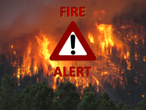
Slim Fire Update as of 6-6-2017

June 6, 2019 9:47 am
The Slim Fire in the Black Mesa Ranger District North of Forest Lakes continues to burn and is producing quite a bit of smoke that is being blown into Navajo and Apache Counties. Arizona Department of Environmental Quality has permanent portable particulate monitors stationed in Show Low and Springerville. The link below will take you to the ADEQ website where you can review the current data from these monitors.
http://www.phoenixvis.net/PPMmain.aspx

WHITE MOUNTAIN ZONE
TYPE 3 INCIDENT MANAGEMENT TEAM
Chris Johnson, Incident Commander

Daily Update
Slim Fire Information: (928) 351-1231 Media Contact: Manny Cordova
Information Office Hours: 8 a.m. to 8 p.m. (928) 351-1231
Incident Email: SlimFire2017@gmail.com
Web: www.fs.usda.gov/asnf
Inciweb: https://inciweb.nwcg.gov/incident/5206/
Facebook: https://www.facebook.com/apachesitgreavesnfs
Twitter: @A_SNFs
Slim Fire
June 6, 2017 at 9:00 am
Location:
Black Mesa Ranger District of the Apache-Sitgreaves National Forests
Coconino County, Arizona
16 miles west of Heber, AZ and 4 miles north of Forest Lakes

Start Date: June 02, 2017 Percent contained: 10%
Size: Approximately 2500 acres Personnel Assigned: 239
Cause: Lightning Growth Potential: Moderate
Vegetation: Ponderosa pine and mixed conifer with litter and understory
Summary: Fire crews will patrol and hold burnouts along existing roads and dozer lines. Continue to utilize air resources at the confluence of Long Tom Canyon and Chevelon Canyon and scout for holding features. The operational period objective will focus and work towards fire containment while providing for firefighter safety.
Structures Threatened: None
Resources Assigned: 5 Type 1 Interagency Hot Shot crews, 2 Type 2 Hand Crews, 4 Type 1 helicopters, 2 Type 3 helicopter, 2 Type 3 Engines, 8 Type 6 Engines, 2 Dozers, 3 Water Tenders, Miscellaneous Overhead, and 2 Air Attack aircraft.
Fire Information:
Know Before You Go:
o Northeastern Arizona Public Information System: https://311info.net/ or call 311 or 928.333.3412
o Arizona Fire Restrictions: http://firerestrictions.us/az/
o Fire Restrictions and Red Flag Alerts: http://wildlandfire.az.gov/
o Wildfires Near Me: http://www.wildfiresnearme.wfmrda.com/

Slim Fire Update

June 5, 2017 9:00 –

Location:

  • Black Mesa Ranger District of the Apache-Sitgreaves National Forests
  • Coconino County, Arizona
  • Approximately 4 miles north of Forest Lakes near Chevelon Canyon

Start Date:  June 02, 2017

Percent contained:  0%

Size:  Approximately 700 acres

Personnel Assigned: 227

Cause:  Lightning

Growth Potential: Moderate

Vegetation: Ponderosa pine and mixed conifer with litter and understory

Summary:  Fire crews will scout, prepare and burn out along existing roads and dozer lines.  Type 1 Helicopters will support crews on the ground at the confluence of Long Tom Canyon and Chevelon Canyon.  The operational period objective will focus and work towards fire containment while providing for firefighter safety.

Structures Threatened: None

Resources Assigned: 5 Type 1 Interagency Hot Shot crews, 2 Type 2 Hand Crews, 3 Type 1 Helicopters, 1 Type 2 Helicopter, 1 Type 3 Helicopter, 2 Type 3 Engines, 7 Type 6 Engines, 2 dozers, 3 water tenders, miscellaneous overhead, and 2 air attack aircraft.

Fire Information:

Know Before You Go:

***Slim Fire Update***

Location: 16 miles W of Heber
– Black Mesa Ranger District
Size: Approximately 350 acres
– 650 acres with back burn operations
Percent Contained: 0%.
Cause: Lightning

Firefighters are currently working to contain the fire utilizing roads, hand lines and dozer lines to minimize impacts to the area.

Aerial resources are being utilized to support ground crews as needed.

With an increased presence of fire crews, please minimize travel on access roads to the fire area!

Also, watch your speed in and around Highway 260 at mile marker 291. Fire vehicles are entering and exiting the highway at this point.

A temporary flight restriction has been ordered, is in effect over the fire area, and remains in place until further notice. This restriction includes drones or unmanned aerial vehicles!

***If you fly, we can’t***