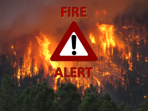
Slim Fire Update 6/8/17

Location: Black Mesa Ranger District of the Apache-Sitgreaves National Forests Coconino County, Arizona 16 miles west of Heber, AZ and 4 miles north of Forest Lakes

Start Date: June 01, 2017
Size: Approximately 3282 acres
Cause: Lightning.
Containment: 50%
Assigned Personnel: 291

Summary: Fire crews will patrol and hold burnouts along existing roads and dozer lines. Continue to utilize air resources at the confluence of Long Tom Canyon and Chevelon Canyon and scout for holding features. The focus today continues to be fire containment, and firefighter and public safety. When visiting the area be alert for heavy fire equipment traffic.

Structures Threatened: None

Resources Assigned: Crews: Five Type 1 Interagency Hot Shot Crews, one Type 2 Hand Crew; Helicopters: One Type 1, one Type 2, one Type 3, two Air Attack aircraft; Engines: Five Type 6, one Type 3; 1 Dozer; 6 Water Tenders; and mis-cellaneous overhead.

Inciweb: https://inciweb.nwcg.gov/incident/5206/ Facebook: https://www.facebook.com/apachesitgreavesnfs Twitter: @A_SNFs

Slim Fire Update 6/7/2017

June 7, 2017 – 1:15 –
Location:
Black Mesa Ranger District of the Apache-Sitgreaves National Forests
Coconino County, Arizona
16 miles west of Heber, AZ and 4 miles north of Forest Lakes

Start Date: June 02, 2017 Percent contained: 30%
Size: Approximately 3000 acres Personnel Assigned: 304
Cause: Lightning Growth Potential: Moderate
Vegetation: Ponderosa pine and mixed conifer with litter and understory.

Summary: There will be a Community Meeting today June 7, at 2:00pm to discuss the Slim Fire and provide an opportunity to ask questions. It will held at The Forest Lakes Community Center, 3031 Old Rim Rd off Highway AZ-260.

Fire crews made good progress in their efforts to mop-up along existing roads, dozer and fire lines. Air resources were used at the confluence of Long Tom Canyon and Chevelon Canyon. They also assisted ground crews in scouting for holding features and fire activity. Today’s operational period objectives will focus towards fire containment while providing for firefighter safety.

Structures Threatened: None

Resources Assigned: 7 Type 1 Interagency Hot Shot crews, 2 Type 2 Hand Crews, 4 Type 1 helicopters, 1 Type 2 helicopters, 2 Type 3 helicopter, 2 Air Attack aircraft, 2 Type 3 Engines, 8 Type 6 Engines, 2 Dozers, 6 Water Tenders, and Miscellaneous Overhead,.

Fire Information:
Know Before You Go:
o Northeastern Arizona Public Information System: https://311info.net/ or call 311 or 928.333.3412
o Arizona Fire Restrictions: http://firerestrictions.us/az/
o Fire Restrictions and Red Flag Alerts: http://wildlandfire.az.gov/
o Wildfires Near Me: http://www.wildfiresnearme.wfmrda.com/

Slim Fire Update as of 6/7/17

June 7, 2017 at 11:00 am
Location:
Black Mesa Ranger District of the Apache-Sitgreaves National Forests
Coconino County, Arizona
16 miles west of Heber, AZ and 4 miles north of Forest Lakes

Start Date: June 02, 2017 Percent contained: 30%
Size: Approximately 3000 acres Personnel Assigned: 304
Cause: Lightning Growth Potential: Moderate
Vegetation: Ponderosa pine and mixed conifer with litter and understory.

Summary: There will be a Community Meeting today June 7, at 2:00pm to discuss the Slim Fire and provide an opportunity to ask questions. It will held at The Forest Lakes Community Center, 3031 Old Rim Rd off Highway AZ-260.

Fire crews made good progress in their efforts to mop-up along existing roads, dozer and fire lines. Air resources were used at the confluence of Long Tom Canyon and Chevelon Canyon. They also assisted ground crews in scouting for holding features and fire activity. Today’s operational period objectives will focus towards fire containment while providing for firefighter safety.

Structures Threatened: None

Resources Assigned: 7 Type 1 Interagency Hot Shot crews, 2 Type 2 Hand Crews, 4 Type 1 helicopters, 1 Type 2 helicopters, 2 Type 3 helicopter, 2 Air Attack aircraft, 2 Type 3 Engines, 8 Type 6 Engines, 2 Dozers, 6 Water Tenders, and Miscellaneous Overhead,.