7/22/23 8:00 am – Residents in the Chevelon Ranches/Retreat areas have been returned to “READY” status today. Additional update for the fire will be shared as they are received from USFS Apache-Sitgreaves Forests.
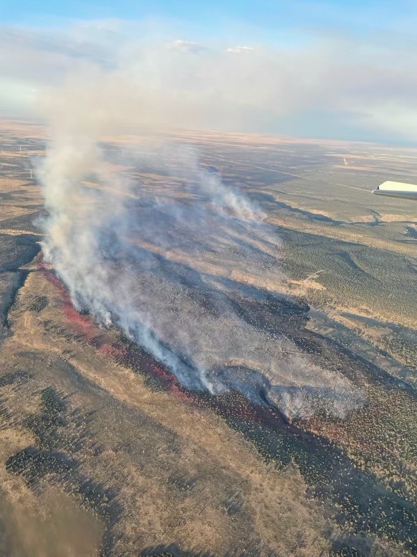
Acres: 1,250 | Containment:
0% | Total personnel: 115 Start
Date: July 19, 2023
Cause: Lightning | Location:
15 miles northwest of Heber-Overgaard
Fuels: pinyon-juniper and
grass
Highlights: The fire transitioned to a Type 3 Incident Commander
yesterday. Suppression personnel made good progress overnight with cooler
temperatures and higher relative humidity.
Operations: Fire personnel are working through
suppression tactics and balancing firefighter safety concerns in the area.A
high priority for personnel is to keep the fire on the west side of Chevelon
Canyon. Resources assigned to the fire include 5 hand crews, 4 dozers, 6
engines 2 water tenders, 3 helicopters, and miscellaneous overhead. Air tankers
will be ordered as needed to assist suppression operations. Moderate movement
is expected.
Evacuations: No evacuations. The areas of
Chevelon Canyon Ranches/Retreat are currently on “SET “status. Please
make sure your go kit is prepared, you have your important papers/documents
gathered and you are following https://311info.net/
for accurate and timely status updates.
Closures: There is a roadblock at the junction
of Forest Service roads 504 and 153. Residence of Chevelon Canyon
Ranches/Retreat are being allowed passage. There is no access on State Route 99
to Chevelon Crossing.
Additional
roads in the area may be restricted or closed depending on the operational
needs of firefighters.
Avoid travel
in the area if possible. If in the area, please watch for fire personnel and
heavy equipment.
Weather: Expect warm, dry, and breezy
today. Cloud cover and a chance of precipitation Friday. Weather information is
available at https://www.weather.gov/fgz/
Acres: 392 | Containment: 0% | Total personnel: 77
Start Date: July 10th, 2023 | Cause: Lightning/Natural | Location: 6 miles SW of Alpine, AZ Fuels: Heavy dead and down from the Wallow Fire of 2011
Highlights: The fire is spreading downhill in heavy dead and down trees with grass understory. Fire activity decreased yesterday because of precipitation. A Type 3 Incident commander has been ordered and is expected to be on the scene today.
Operations: Contain/confine strategies continue today. Monitoring, confinement work from existing forest service roads and containment operations will continue as weather and fire conditions allow, while simultaneously considering firefighter safety first. Minimal movement in all directions is expected.
Evacuations: No evacuations currently.
Weather: Thunderstorm activity is expected to continue in the general area, accompanied by potential lightning activity.
Restrictions: The Apache-Sitgreaves National Forests are in Stage I Fire and Smoking Restrictions, learn more at: https://www.fs.usda.gov/alerts/asnf/alerts-notices/…
Information related to fire restrictions across public and private land can be found at: https://ein.az.gov
Forest roads in the area may be restricted or closed depending on the operational needs of firefighters.
Smoke: An interactive smoke map at fire.airnow.gov/ allows you to zoom into your area to see the latest smoke conditions. Smoke may be visible from Hwy 191, especially at night.