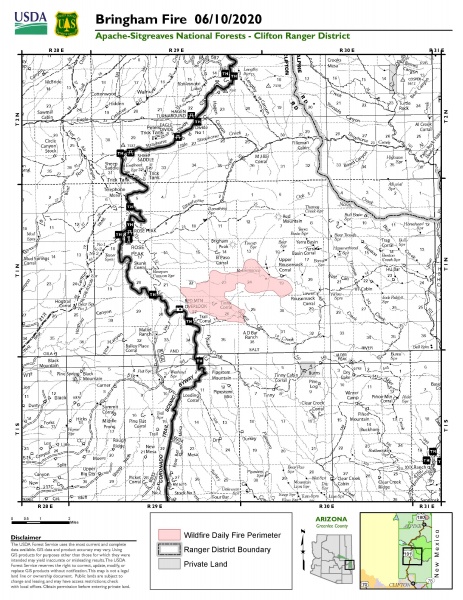
Location of Origin: Apache-Sitgreaves National Forests, Clifton Ranger District
Start Date: June 6, 2020
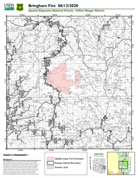
Size: Approximately 10,803 Acres
Cause: Lightning
Percent Contained: 0
Personnel: 180
Resources Assigned: 4 hotshot crews, 1 initial attack crew, 3 Type 6 engines, 1 Type 3 engine, 2 water tenders, 1 Type 1 helicopter, 1 Type 2 helicopter, 1 Type 3 helicopter, various incident management overhead.
Thunderstorm Winds Push Bringham Fire
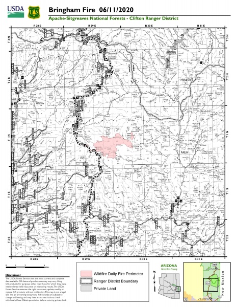
A thunderstorm moved into the area on Thursday producing strong erratic outflow winds, pushing the head of the fire to the northwest. As the fire progressed toward a trigger point near the Rose Peak lookout facility, fire crews began burnout operations to keep the fire east of Highway 191. Fire managers worked closely with the National Weather Service office in Tucson who provided the team with real-time tracking of the thunderstorm system, which was crucial in informing on-the-ground tactical decisions.
The weather for the Bringham fire is calling for dry thunderstorms today with gusty and erratic winds up to 35 miles per hour. The Bringham Fire is burning in steep, remote, inaccessible terrain, and erratic winds continue to push the fire North, West and Southwest, and continues to threaten US 191/Coronado Trail.
Burnout operations will continue today as needed if the fire reaches established trigger points along Highway 191. Burnout operations can produce large amounts of smoke, and although these tactics are vital to successful firefighting operations, smoke from wildfires can be hazardous to your health. The Arizona Department of Environmental Quality operates a network of portable particulate monitors across Arizona so that anyone can view air quality by visiting their website at https://www.phoenixvis.net/ppmmain.aspx.
Due to the increased complexity of the Bringham fire, a Type 2 Southwest Incident Management Team will be assuming command of the Bringham Fire at 0600 on Saturday, June 13.
A temporary Closure Order has been implemented for the Bringham fire and can be accessed at https://www.fs.usda.gov/detail/asnf/alerts-notices/?cid=stelprd3793918. Highway 191 is closed in both directions between mile-marker 189 (just past Juan Miller road) and mile-marker 225. More information can be found at https://azdot.gov/adot-news/us-191-closed-eastern-arizona-mountains-due-bringham-fire.
Fire information can be found on InciWeb at https://inciweb.nwcg.gov/incident/6747/. Information about the Apache-Sitgreaves National Forests can be found at www.fs.usda.gov/asnf.