Buckelew Vicnity 2015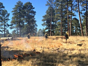 Prescribed burning planned for 500 acres in Vernon area
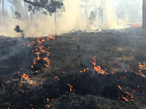
Springerville, AZ –June 4, 2015; —The Springerville Ranger District is planning on burning next week weather permitting. They plan to burn approximately 500 acres just southeast of Apache County road 3140, which is the road leading to Vernon.
Smoke will be seen from Round Valley, Arizona State Highway 260, U.S. Highway 60 and along Forest Road 61. The burn is to enhance wildlife habitat and watershed conditions, as well as, to promote forest health. This prescribed fire is in cooperation with the Arizona Game and Fish Department’s Habitat Partnership Committee.
All prescribed burns are approved through the Arizona Department of Environmental Quality (ADEQ) before ignitions begin. The ADEQ monitors air quality and determines whether or not it will be a good day for smoke dispersion. Breaking larger burn areas into smaller acreages often limits the amount of smoke that impacts an area. Although smoke from prescribed fire can still be a nuisance, it is usually for a shorter time and considerably less smoke than wildfires produce. If you are sensitive to smoke or have respiratory problems, stay indoors if possible.
Crews will be on scene from the beginning of ignitions until dark and through the weekends monitoring fire behavior and weather conditions.
Questions or concerns contact Rob Lever, Springerville Ranger District Fire Management Officer at (928) 333-6203 or by calling 311 or 928-333-3412. Also, check out the ASNFs website at: www.fs.usda.gov/asnf