US 60 is now open to through traffic between the “Y” and Vernon store. Please drive safely.
US60 Is Now Open
Reply

US 60 is now open to through traffic between the “Y” and Vernon store. Please drive safely.
 12/18/15 2:15 pm
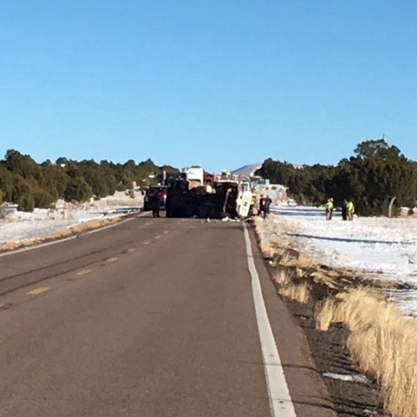
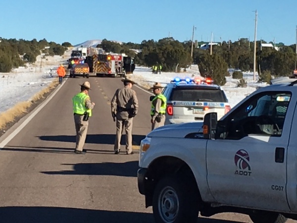
US60 is closed in both directions at milepost 357 between the”Y” and the Vernon store due to a propane tanker rollover. Fire crews are on scene and traffic is being rerouted through St Johns. Updates will be provided as they become available.
3:45 PM
Traffic continues to be rerouted through St. Johns due to the single vehicle propane tanker rollover accident. US60 will be closed until the tanker is removed and the scene is cleared by DPS. Plan on this detour lasting through the next few hours. Drive carefully and use caution in the detour area.
12/14/15 – A Winter Weather Advisory remains in effect until 6:00 pm this evening. Continuous moderate to heavy snow across the area this morning until around 10 AM then snow transitioning to more of a showery nature by late morning and afternoon. Near whiteout conditions could occur at times in the heavier snow burst especially from mid-afternoon until early evening hours. The heavy convective snow burst could last from several minutes to up through an hour especially if a snow shower band becomes stationary over a particular area. Snow levels down to 3500 feet this morning then down to around 3000 feet this afternoon.
Snow accumulations are estimated between 2 to 8 inches. The greatest snow amounts will fall above 6000 feet.
Gusty winds from 15 to 25 MPH with gusts near 40 MPH will cause significant issues with blowing and drifting snow as well as reduced visibility.